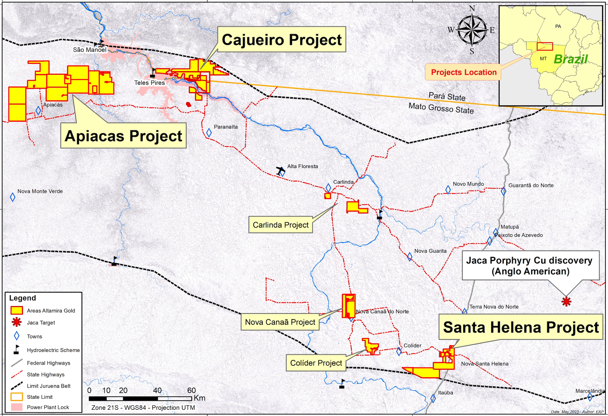
Cajueiro
Advancing one of brazil’s most promising gold deposits.
Overview
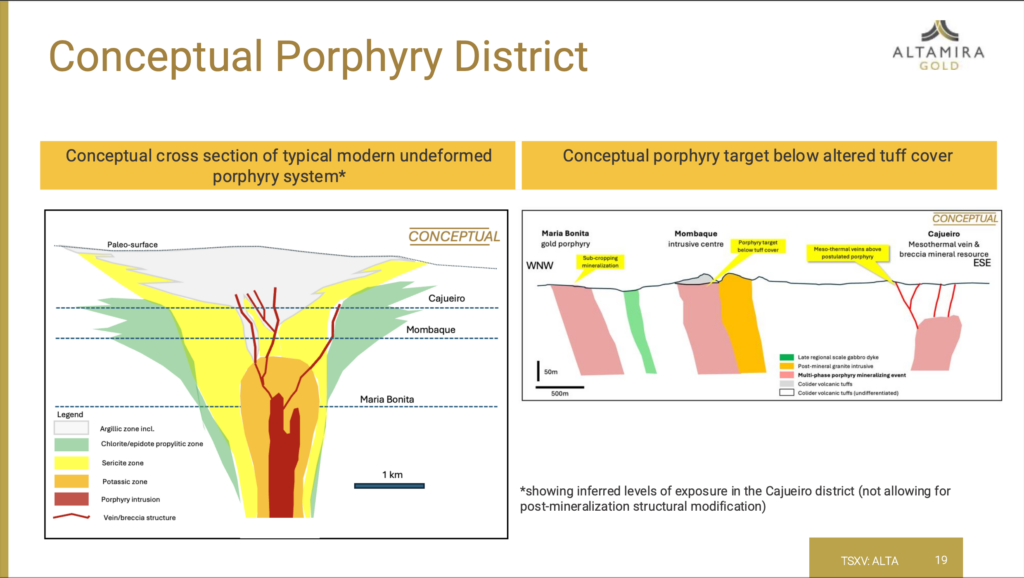
Ongoing exploration and fieldwork point to the likelihood of multiple porphyry-related gold systems at Cajueiro, creating a compelling case for district-scale discovery and development. These potential hard-rock sources align with historical alluvial gold production, underscoring the project’s robust gold endowment and potential scalability.
Extensive trenching and drilling at Cajueiro have delineated 185,000 ounces of Indicated Resources and 515,000 ounces of Inferred Resources at the Central Deposit, with substantial upside as the deposit remains open both at depth and laterally. The 2019 Mineral Resource estimate, conservatively based on a gold price of US$1,500 per ounce covers an area of around 28,000 ha. The resource remains open in several directions and recent work has identified several potential lateral extensions which will shortly be drill tested.
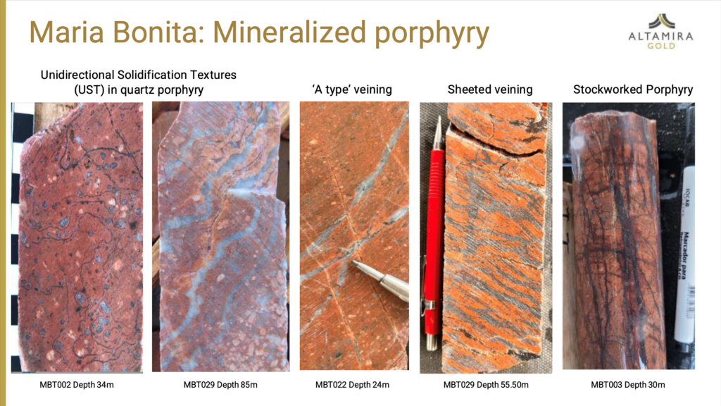
A maiden mineral resource estimate for the Maria Bonita porphyry gold deposit within the Cajueiro Project was released in May, 2025. Maria Bonita is a separate discovery, located 7km to the west of, and additional to, the Cajueiro Central Mineral Resource.
The maiden open-pit resource consists of total Indicated Resources of 24.19Mt @ 0.46g/t gold (for a total of 357,800oz) and Total Inferred Resources of 25.64Mt @ 0.44g/t gold (for a total of 362,400oz). These resources include near-surface saprolite Indicated Resources of 2,02Mt @ 0.59g/t gold (for a total of 38,000oz) and Inferred Resources of 0.68t @ 0.40g/t gold (for a total of 8,700oz). These resources were calculated using a 0.2 g/t gold cut-off grade.
A significant higher grade near-surface resource has also been identified and at a 0.5 g/t gold cut-off comprises Indicated Resources of 7.56Mt @ 0.72g/t gold (176,250oz) and Inferred Resources of 5.18Mt @ 0.92g/t gold (152,940oz).
Mineralization extends to surface and the relative volume of waste to mineralized material within the optimised pit is 0.5:1. The deposit remains open to the west, south and at depth.
Maria Bonita is the first of nine porphyry-gold targets that have been identified so far within the Cajueiro district and further drilling will be aimed at both expanding Maria Bonita and initial drill testing of the eight other targets.
Project Summary
ShareProject
Cajueiro
Location
Alta Floresta Gold Belt, Brazil
Indicated Resources
185,000oz at Central and 357,800oz at Maria Bonita
Inferred Resources
515,000oz at Central and 362,400oz at Maria Bonita
Status
Ongoing drilling & trenching
Infrastructure
Hydropower & roads